


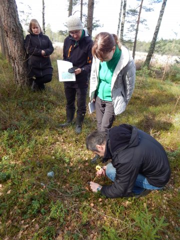
In the morning of April 12, under the guidance of the expert from the Institute of Environmental solutions Oskars Purmalis, HYDROPLAN project team together with colleagues from Pieriga Regional Administration of The Nature Conservation Agency and cooperation partners from ELM MEDIA have identified water level monitoring sites and mastered the manual methodology of determination of the level of ground and surface water.
Measurements took place in several places around Zaļais purvs near Ķemeri, Smārdes Kūdra, Lapmēzciems and Antiņciems. In these places water level has been measured since the beginning of the project in 2012 both with meters, which data is read automatically in accordance with set time period, and with manual meters, which data must be read regularly and frequently on the spot. Transfer of experience and knowledge allows to provide further monitoring of water level of the territory, which must be carried out every 5 years after the completion of the project.
These observations will allow us to follow how a naturalness of the bug is carried out after the renewal activities, which include digging, because the changing in plants will follow after changing of water level only after a period of time and will be observed gradually.